While digging through the old Rosewood Taxpayers’ Association newsletters, photos and documents, we came across some old maps someone had previously obtained from the Scarborough Archives. Here they are, because I can’t be the only one curious and interested in what Rosewood was like 100 years ago.

This first is simply a close-up. The white and red dots marked the boundaries of what we now know as Rosewood, though the street names are unclear.
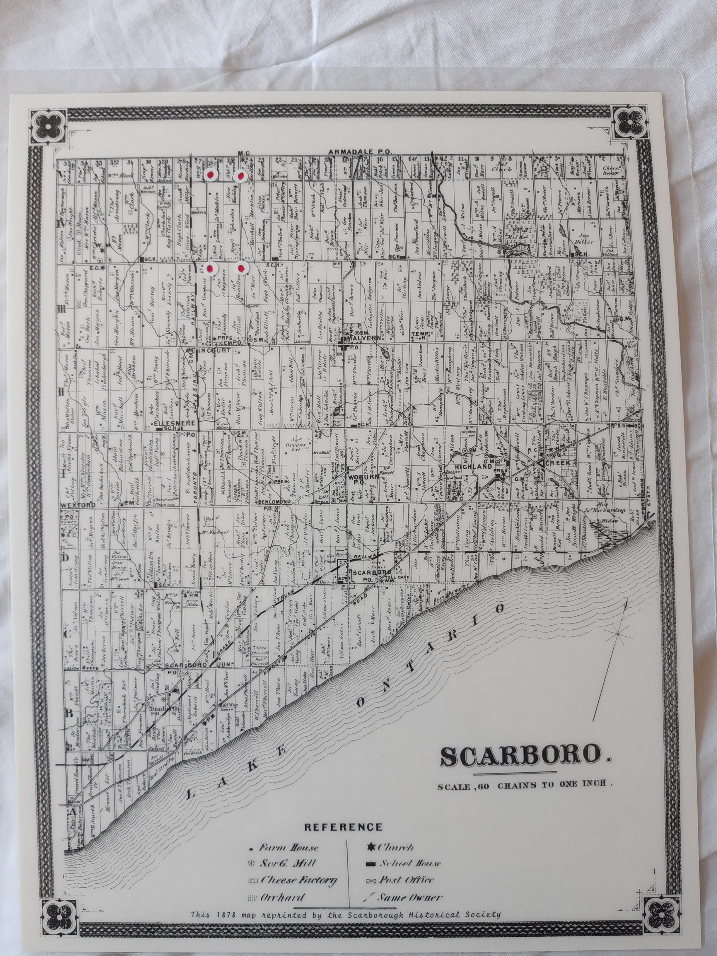
Here is the 1878 full Scarboro map, showing the boundaries of Scarborough from Lake Ontario to the south and Markham to the north.
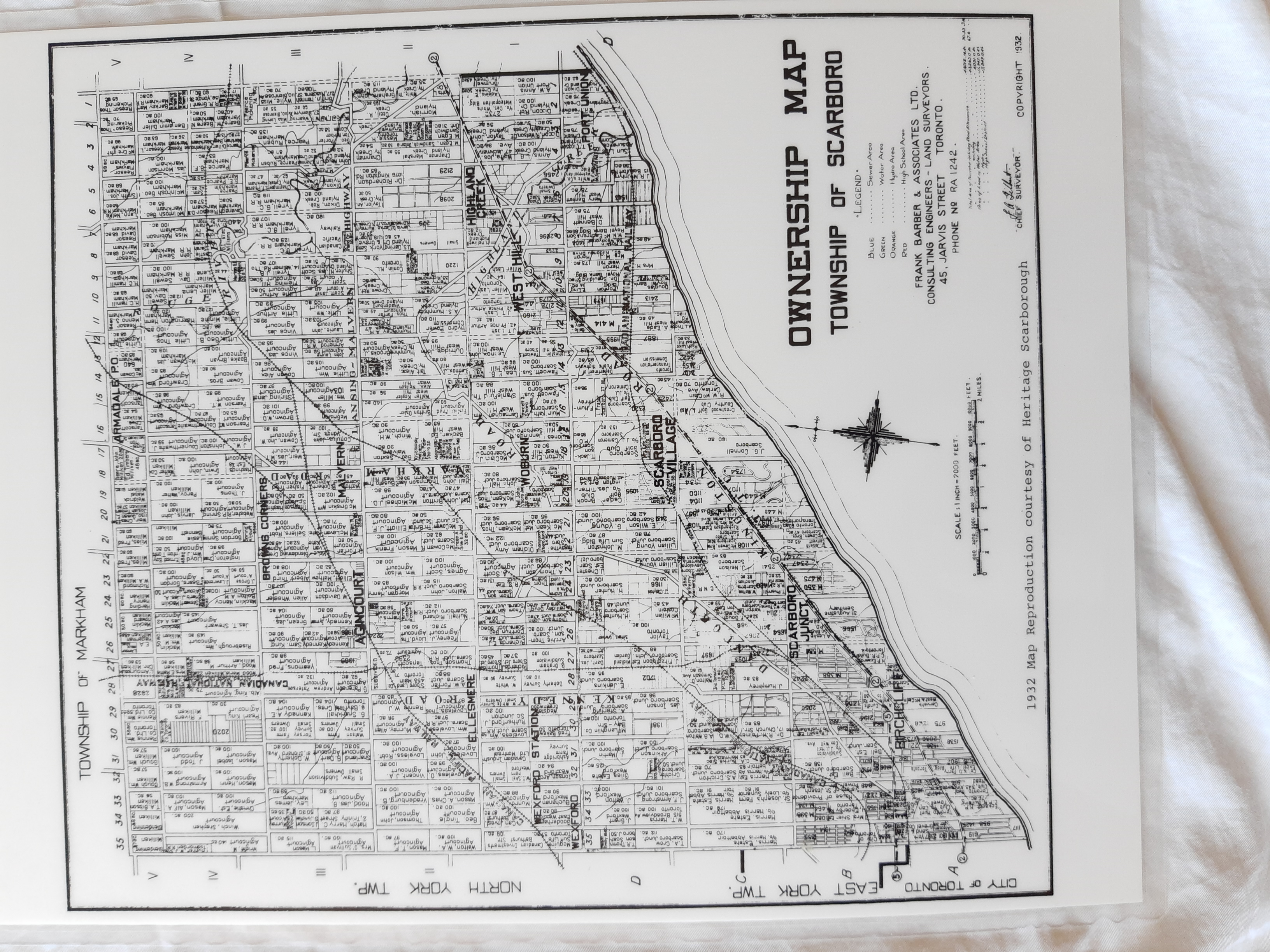
Oops, I seem to have missed the one from 1910. But here we are in 1932.
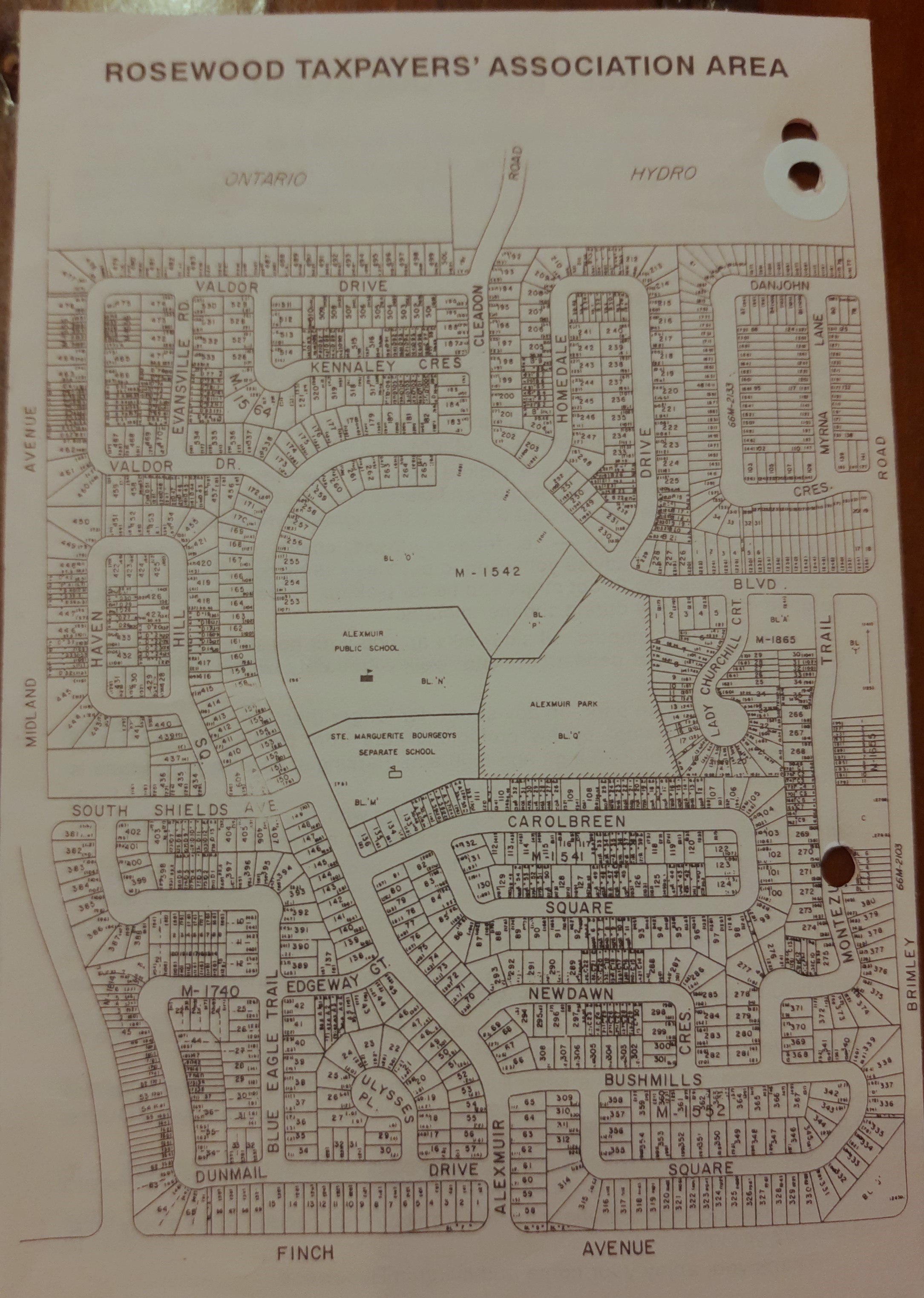
Finally, this is an old map of modern day Rosewood. If you joined us on community clean-ups in past decades you may have received one of these in order to complete your rounds.
If this is something that interests you and you would like to help us compile a more complete history of the area, please comment here or contact us. The next Rosewood AGM will be held on October 15, 2024 from 7-9pm at Alexmuir Junior Public School. Come say hi!
